NEWS RELEASE – FOR IMMEDIATE RELEASE
Media contact: Steve Stuebner, 208-484-0295, [email protected]
Flood #10 contact: Mike Dimmick, 208-861-2766, [email protected]
Idaho Water Resource Board contact: Brian Patton, 208-287-4800, [email protected]
Flood District #10 completes $350,000 flood management project near Middleton to protect private property
MIDDLETON – (April 3, 2023) – Boise River Flood Control District #10 recently completed a $350,000 flood management project on the Boise River near Middleton to enhance river flow and prevent bank erosion on private property. Half of the project’s cost was funded by a $175,000 flood management grant from the Idaho Water Resource Board.
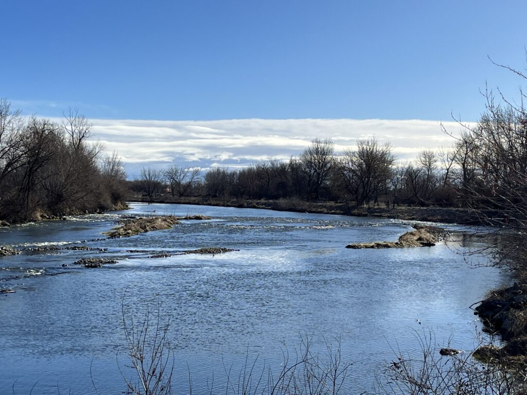
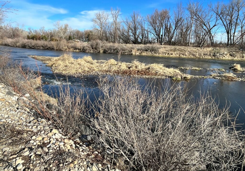
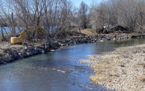
Contractors for Flood #10 just finished in-stream and riverbank-restoration work, including the integration of willows and riparian vegetation for bank stability. They also removed approximately 48,000 cubic yards of gravel in a ¾-mile section of the Boise River.
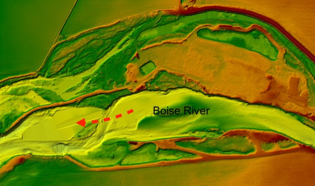
The “Canyon Reach” project location was identified following a scientific sediment study by Andy Tranmer, a professor at the University of Idaho and the Director of the Center for Ecohydraulics Research. The study details how river sediments, gravel and rocks are moved down the Boise River corridor below Diversion Dam during spring high flows over time.
In the “Canyon Reach” section of the Boise River near Middleton, aerial photography over time shows how the river’s dynamics have dropped out large amounts of river sediments, gravel and river rock where the river flattens out and slows down, said Mike Dimmick, District Manager for Flood #10.
“It’s a bit of an experiment for us,” Dimmick said of the project. “This is the largest area of gravel build-up we have below Eagle Island. That’s because below Star, the river loses gradient, loses velocity, and you get gravel bar build-up. The river slows down and drops the sediment load.”
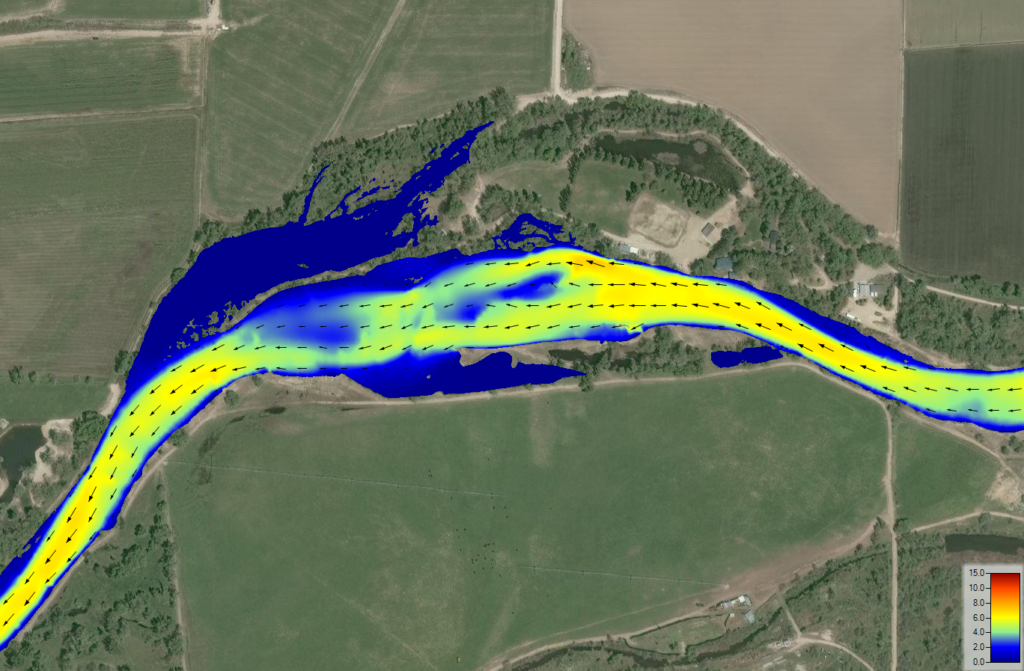
Flood #10’s new Boise River 2D Model Tool, also financed in part by the Idaho Water Resource Board, has been a key tool in planning and designing the Canyon Reach flood management project, said Mike Schubert, a project engineer for HDR in Boise.
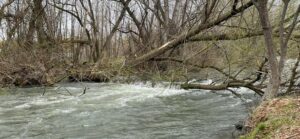
“The 2D Model shows the river velocity in a spectrum of colors and you can see how the velocity decreases in the Canyon Reach section of the river,” Schubert said. “We will continue to see that trend over time. But removing the gravel takes the stress off the river banks. And we’re re-locating riparian vegetation to bio-stabilize the bank.”
The project required permits and approvals from the Idaho Department of Water Resources, Army Corps of Engineers, Idaho Department of Environmental Quality, and the Idaho Department of Fish and Game.
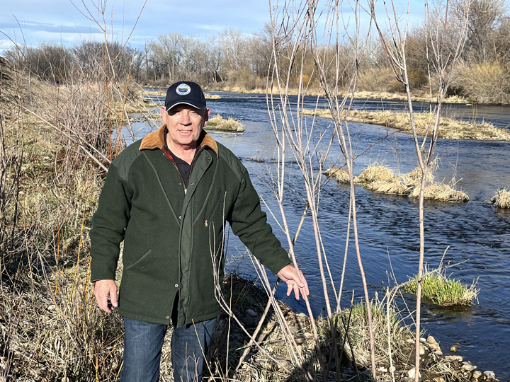
Middleton farmer Dick Bicandi is pleased with how the flood management project turned out, especially with riverbank barbs and willows installed on edge of his property to slow down river flow next to the bank and deflect the river’s energy back into the river.
“It’s awesome, this work needed to be done,” Bicandi said. “It stops the erosion on the river bank. Before, the river has been eating away my property. This is going to help a lot.”
Lurre Construction in Caldwell was the project contractor for Flood #10. A royalty of $1.15 per cubic yard of river rock will be paid to the Idaho Department of Lands.
Using the 2D Model Tool, more projects can be identified along the Boise River to solve flood management issues, Dimmick said. “This is an example of what we need to do in the future. Especially from here downstream to the Snake River,” he said.
“The 2D Model Tool helps us understand the river better and will help us continue to improve management,” Schubert added.
For more information, contact Mike Dimmick, Flood District #10 project manager, 208-861-2766, or go to boiseriver.org.
################################################